![]()
![]()
Work on the basin of Claudius started in 42 AD, a date deduced from a description by Cassius Dio. Plutarchus says that the work had already been contemplated by Julius Caesar ("to enclose the sea by building moles"), but Suetonius informs us that it was never started ("often been thought of by the Deified Julius, but given up because of its difficulty"). The work made sense, because Ostia had no natural harbour, and besides, the people of Rome left him no other choice:
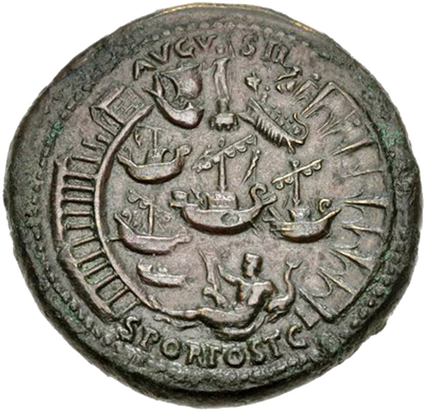
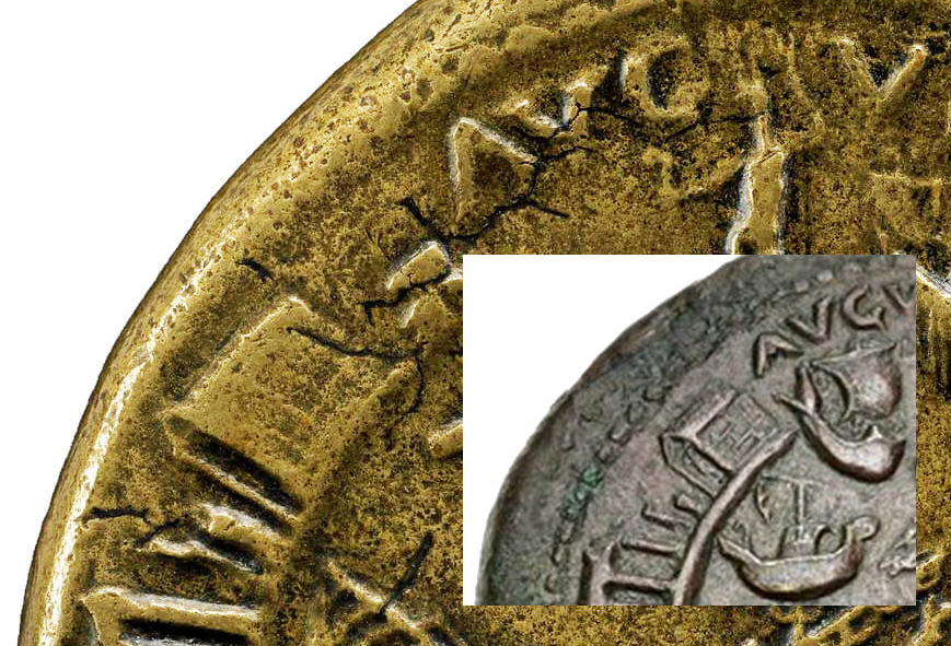
Artiore autem annona ob assiduas sterilitates detentus quondam medio Foro a turba conviciisque et simul fragminibus panis ita infestatus, ut aegre nec nisi postico evadere in Palatium valuerit, nihil non excogitavit ad invehendos etiam tempore hiberno commeatus. Nam et negotiatoribus certa lucra proposuit suscepto in se damno, si cui quid per tempestates accidisset, et naves mercaturae causa fabricantibus magna commoda constituit pro condicione cuiusque: civi vacationem legis Papiae Poppaeae, Latino ius Quiritium, feminis ius IIII liberorum; quae constituta hodieque servantur. When there was a scarcity of grain because of long-continued droughts, he was once stopped in the middle of the Forum by a mob and so pelted with abuse and at the same time with pieces of bread, that he was barely able to make his escape to the Palace by a back door; and after this experience he resorted to every possible means to bring grain to Rome, even in the winter season. To the merchants he held out the certainty of profit by assuming the expense of any loss that they might suffer from storms, and offered to those who would build merchant ships large bounties, adapted to the condition of each: to a citizen exemption from the lex Papia Poppaea; to a Latin the rights of Roman citizenship; to women the privileges allowed the mothers of four children. And all these provisions are in force to-day. Suetonius, Claudius XVIII. Translation J.C. Rolfe. The Basin of Claudius is depicted on sestertii of Nero. The coins were struck by the mint of Rome in 64 AD, and by that of Lugdunum (Lyon, France) in 65-67 AD. The coins from Rome were made with at least 15 different dies, and carry the text POR(tus) OST(iensis) AVGVSTI S(enatus) C(onsultu), those from Lugdunum leave out the word Ostiensis. We see two curved moles enveloping a basin with ships. The main difference between the dies is the number of ships. The minimum number of vessels is six, the maximum eleven. Three ships can always be seen: a cargo ship under full sail that is entering the harbour, a cargo ship with furled sails in the centre of the basin, and an oared military ship. The moles are not identical. The wide opening at the top suggests that we see the harbour from the east. The mole on the left is then the south mole. The mole on the right, the north mole, has arches. These have been regarded as a way to allow sand, taken by the Tiber into the harbour, to be swept out again. Such arches have not (yet) been confirmed by excavations however.
Sestertius of Nero from 64 AD, with the harbour of Claudius. Photo: Wikimedia.The coins may mark the formal completion of the work begun by Claudius, or celebrate the 10th anniversary of the completion of the harbour, or refer in general to Nero's care for the food-supply of Rome. The last option is the most plausible. Suetonius says that Claudius completed (perfecit) the work:
Opera magna potius et necessaria quam multa perfecit, sed vel praecipua: ductum aquarum a Gaio incohatum, item emissarium Fucini lacus portumque Ostiensem.
Portum Ostiae exstruxit circumducto dextra sinistraque brachio et ad introitum profundo iam solo mole obiecta.The public works which he completed were great and essential rather than numerous; they were in particular the following: an aqueduct begun by Gaius; also the outlet of Lake Fucinus and the harbour at Ostia.
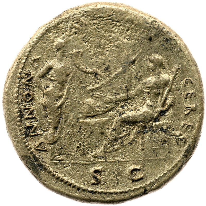
He constructed the harbour at Ostia by building curving breakwaters on the right and left, while before the entrance he placed a mole in deep water.Suetonius, Claudius XX. Translation J.C. Rolfe. It seems significant that also in 64 AD a coin was issued with Annona, the personification of the food-supply, and Ceres, a goddess related to grain, in front of a ship's stern.
Sestertius of Nero from 64 AD, with Annona and Ceres. Photo: British Museum.In any case, already in 62 AD the harbour was in use: in that year 200 ships in the basin perished during a storm. It has often been said that therefore Claudius' basin was unsafe. It is hard to believe however that so many ships, safely moored, perished in a storm. It is more likely that the destruction was caused by a tsunami, the result of the same seismic activity that is documented in that year in Pompeii (the earthquake of February 5, 62 AD).
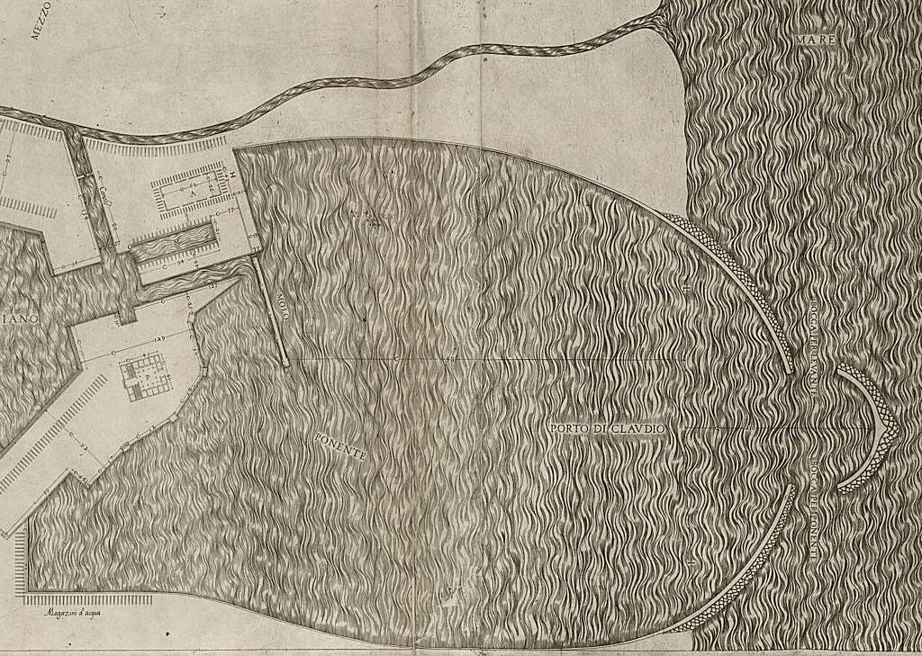
The earliest detailed plan of the basin of Claudius was made by Antonio Labacco in the 1550's. It reflects what we see on the Neronian coin, and so do the reconstructions from the second half of the 16th century: a north and a south mole, and an entrance on the west side.
Plan of the basin of Claudius according to Labacco (1550's). South is up.
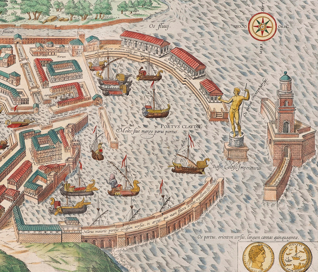
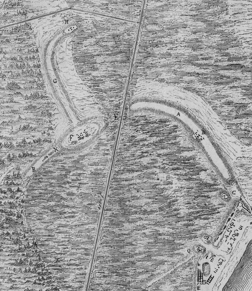
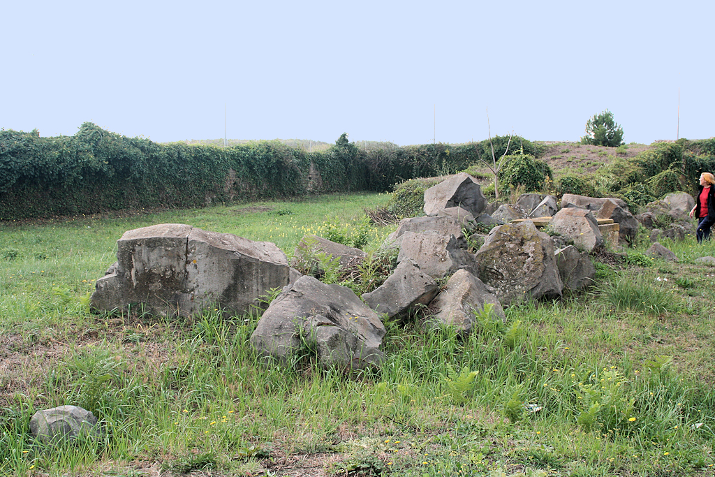
Reconstruction of the basin of Claudius by Georg Braun and Frans Hogenberg (1580). South is up.In the 19th and 20th century, when the remains were largely buried, many scholars reconstructed a much smaller basin, with an entrance on the north side. In 1827 Antonio Nibby gave a brief description of some visible remains, using the plan by Luigi Canina from the same year. He recognized ridges (A, B); ruins of buildings (C, D); an entrance of the basin on the north side (E), 80 meters wide; a platform measuring 180 x 90 meters (F) and believed to be the foundation of the lighthouse; a ridge called Monte dell'Arena (G); and finally a small mound with ruins (H).
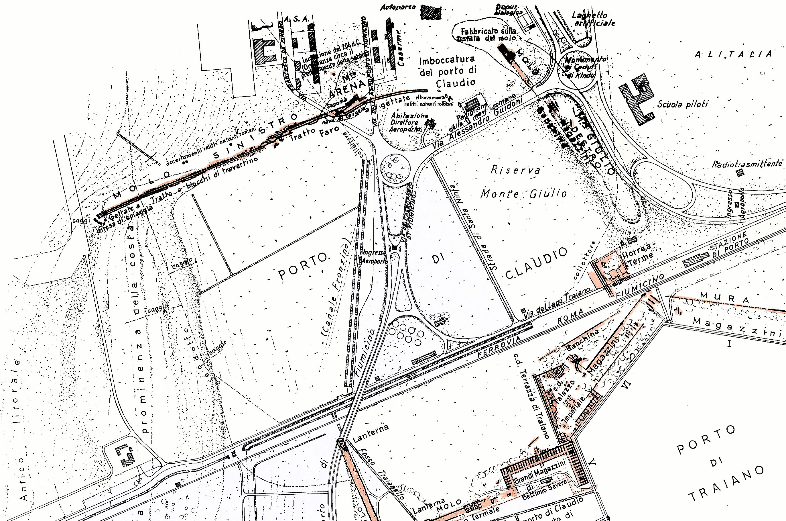
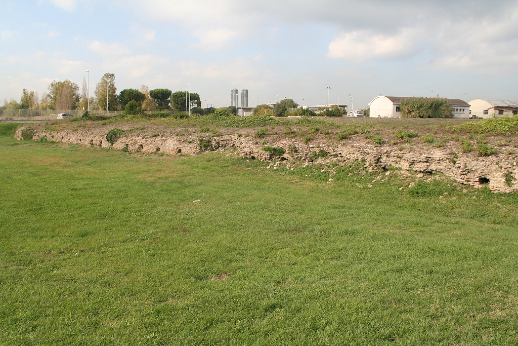
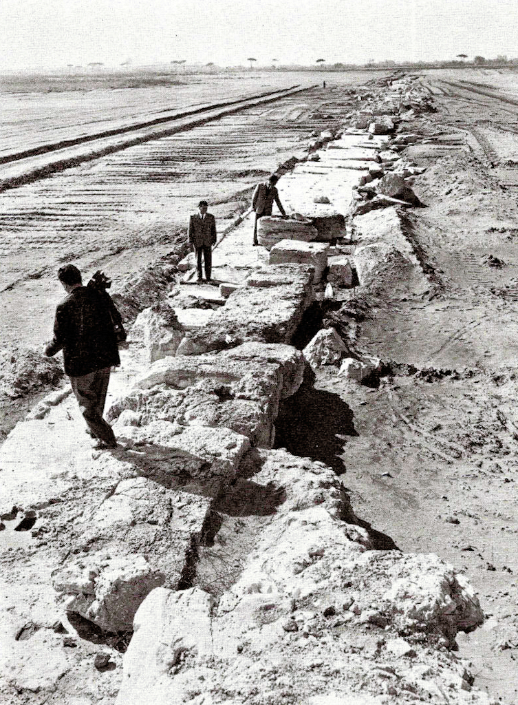
Plan of the basin of Claudius according to Canina (1827).A bit of excavating in the area was done by Jérôme Carcopino in 1907 and by Giuseppe Lugli in the 1930's. Large stretches of the north mole were excavated by Otello Testaguzza during the construction of Leonardo da Vinci airport, immediately to the north, in the years 1958-1961. The area of the basin was easily recognizable, because it was at a lower level than the surrounding terrain. There were recent drainage channels, one to the west called Coccia di Morto, the other on the east side, called Fronzino. Sandy ridges to the west are regarded by Testaguzza as a natural border of the basin. He distinguishes a left mole ("molo sinistro"), known today as the right (north) mole, and a right mole ("molo destro"), today recognized as the back of the basin (Monte Giulio). He concludes that the main entrance of the harbour was to the east of Monte Arena.
Click on the image to enlarge. Plan of the basin of Claudius according to Testaguzza (1970, 150-151).
Top left is the north mole ("molo sinistro"), to the right the back part of the basin ("molo destro").
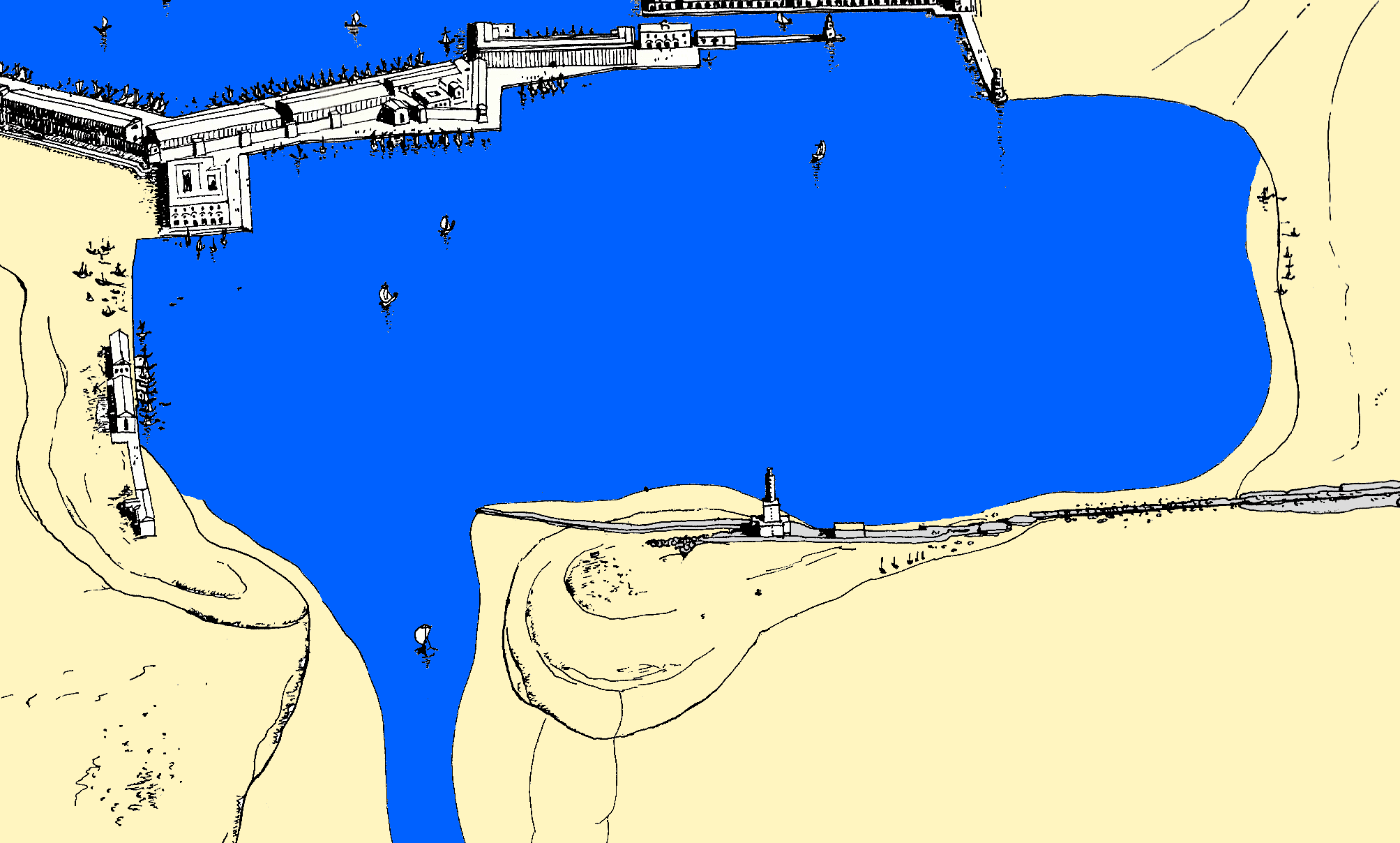
Click on the image to enlarge. Reconstruction of the basin of Claudius according to Testaguzza (1970, 154-155), seen from the north.The north mole (Testaguzza's left mole) consisted at the west end, over a length of 75 meters, of concrete. Two phases were recognized, the first six meters wide, the second set against its north side and an additional four to five meters wide.
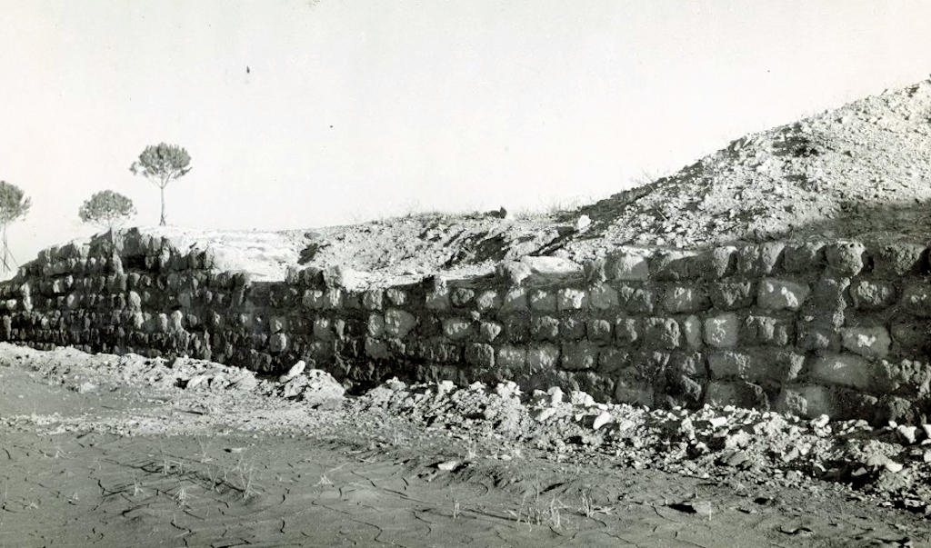
The westernmost part of the north mole excavated by Testaguzza. Photo: American Academy Rome.The part to the east, 758 meters long, had a foundation of huge basalt blocks and of concrete pierced horizontally by square holes for wooden beams. This part of the mole seems to have been built as prescribed by Vitruvius (De architectura 5,12). It too was later reinforced.
Large basalt blocks, belonging to the base of the mole. To the right Antonia Arnoldus-Huyzendveld. Photo: Jan Theo Bakker.
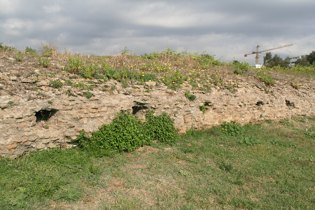
Remains of the north mole near Monte Arena. Note the holes in the side. Photo: Jan Theo Bakker.
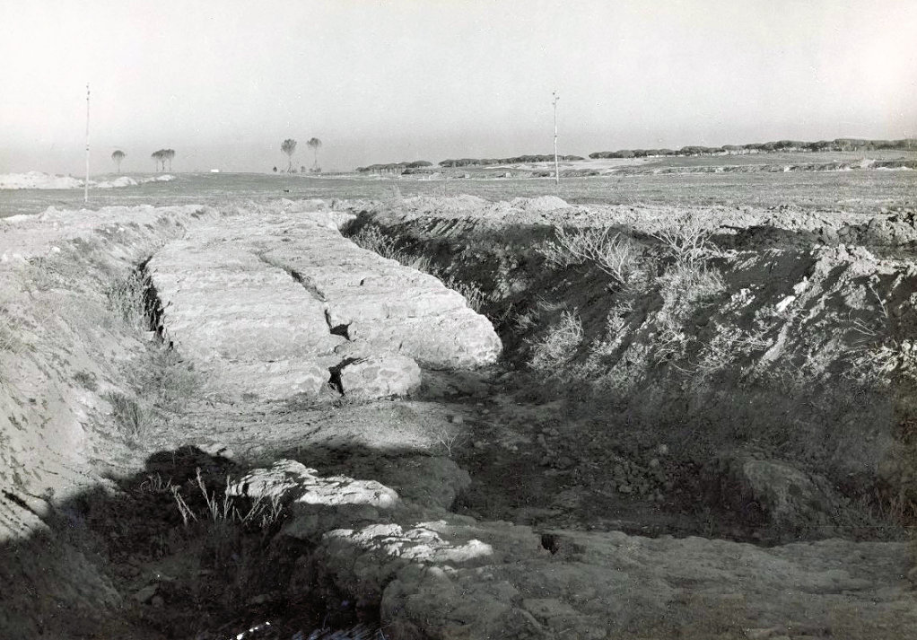
Detail of the north mole near Monte Arena. Photo: Jan Theo Bakker.The western half of this long section, 333 meters long and c. 3.30 meters wide, was covered by four layers of large travertine blocks, joined together by iron pegs set in a bed of lead.
Travertine blocks covering the central part of the north mole. Testaguzza 1970, 87.The eastern half of this section is 425 meters long. The north side had a facing of small and large tufa blocks. The western part of it was 9-17 meters wide. This part was identified by Testaguzza as a tufa platform for the lighthouse of Claudius. He even recognized the shape of the ship that was sunk for its foundation, as described by Pliny the Elder and Suetonius. The slightly curved eastern part was 5-5.50 meters wide. Further to the east Testaguzza found an opening, 206 meters wide. This he identified as the main entrance of the harbour, connected with the sea through a canal going to the north-west, 50-60 meters wide.
Facing of tufa blocks on the eastern end of the north mole. Photo: American Academy Rome.Testaguzza's work seemed to confirm the hypothesis of a small basin with an entrance on the north side. However, this reconstruction was wrong. The full course of both moles was established in the 21st century, through the same drillings by Antonia Arnoldus-Huyzendveld that revealed the location of the lighthouse of Claudius (a total of 267 drillings, to a depth of 10-20 meters). It turned out that the situation was accurately represented on the plan and reconstructions from the second half of the 16th century: an east-west running north and south mole, with an isolated lighthouse slightly to the west. Even the measurements were correct. On the plan of Antonio Labacco from the 1550's the distance between the so-called North-south mole (see Harbour of Trajan, nr. 7) and the lighthouse of Claudius is indicated as being 1469 meters. Arnoldus-Huyzendveld measured 1420-1430 m. The northern mole turned out to be 1600 meters long, the southern one approximately 1320.
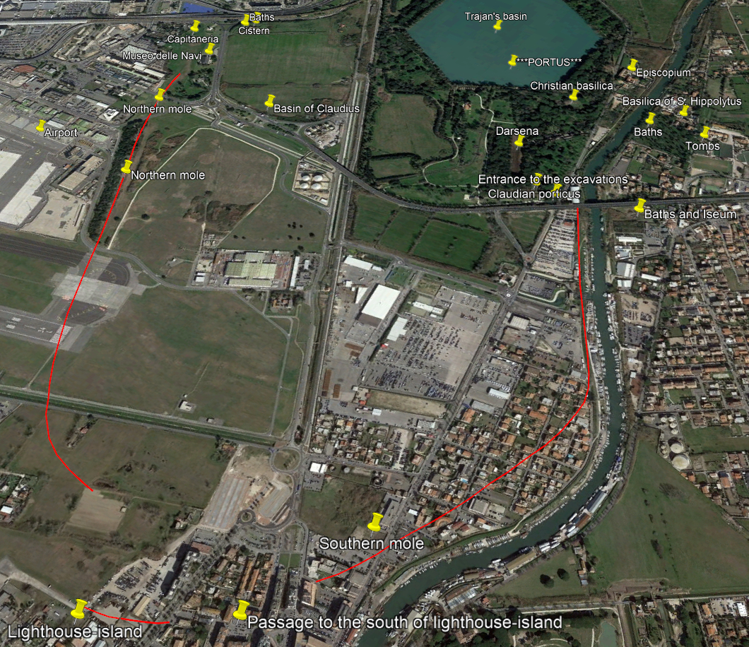
The basin of Claudius on Google Earth, seen from the west.
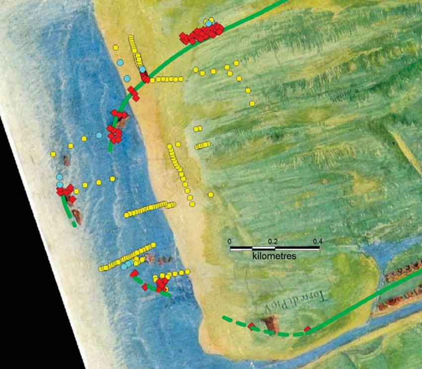
The drillings in the west part of the basin, shown on a painting of Portus by Ignazio Danti from 1582.
Brown: Roman remains depicted by Danti. Red: Roman remains found in the drillings.
Yellow and blue: water (blue for strong current). Green lines: course of the moles.
Image: Antonia Arnoldus-Huyzendveld.The east part of the basin, shallower than the west part (seven meters deep), seems to be a former lagoon behind dunes. As to the presence of a secondary entrance on the north side (regarded by Testaguzza as the main entrance): so far the geoarchaeological research is inconclusive. This area remains problematic.
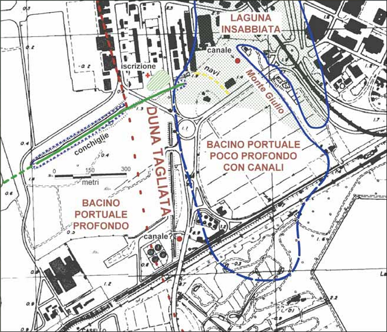
Map of the deep west and shallow east part of the basin, the latter a former lagoon.
The dunes in between were removed by Claudius. The green line is the north mole.
Image: Antonia Arnoldus-Huyzendveld.Finally a few more words about the Neronian coin. At the end of the left, south mole a temple can be seen, apparently with a person sacrificing in front of an altar. On the remainder of the mole is a colonnade. In late antiquity the Porticus Placidiana was erected on the south mole (see the harbour of Trajan, nr. 55), but it may have been a refurbished and renamed Claudian porticus.
The temple on the southern mole, as seen on two of Nero's coins.Two figures on the coin deserve our attention. At the bottom is a reclining male deity, leaning on a dolphin and holding a rudder with his right hand. It cannot be the personification of the Tiber, which may be depicted with a rudder, but is never accompanied by a dolphin, a sea animal. Neither can it be Oceanus or Neptunus, who are not associated with rudders. Most likely it is a personification of the harbour itself.
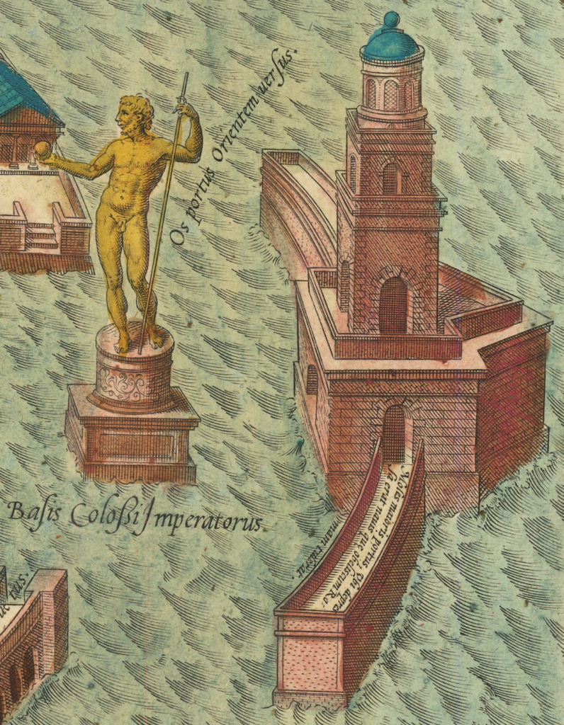
At the exit of the harbour we see a statue of a figure standing on a base and a short column. On the reconstruction drawings of the 16th century it is shown as an isolated statue of an Emperor, holding a sceptre and a globe, and standing in front of the lighthouse. According to some modern scholars it is a symbolic representation of the lighthouse.
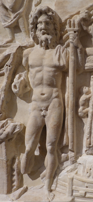
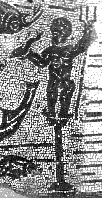
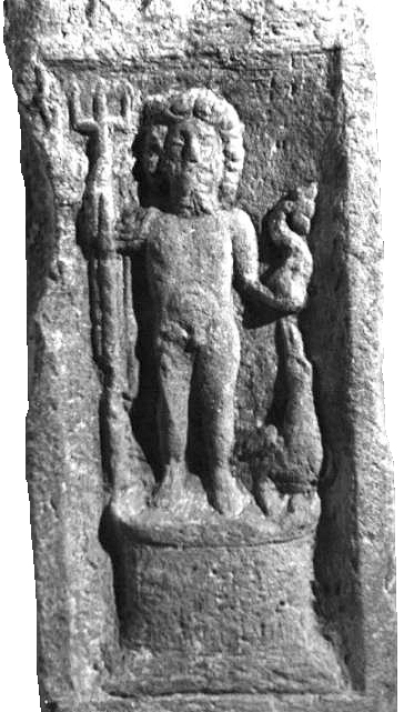
The statue in front of the lighthouse on the reconstruction by Georg Braun and Frans Hogenberg from 1580.A more attractive solution is, that it was a statue of Neptunus, standing on its own base. An isolated statue of Neptunus with a trident in one hand and a dolphin in the other has a prominent position on the Torlonia relief. A similar statue can be seen on a mosaic in the House of the Harbour Mosaic (I,XIV,2) in Ostia, and on an altar erected in Germany by a physician from Ostia (see the topic Famous people in Ostia and Portus: the ancient Greeks). The latter two depictions have Neptunus on a column. The old reconstructions may well be close to reality once more.
Neptunus on the Torlonia relief.
Photo: Annewies van de Hoek.Neptunus on a mosaic found in Ostia.
Photo: Scavi di Ostia IV, Tav. 161.Neptunus on an altar found in Germany.
Photo: museum.com.
![]()
![]()