![]()
![]()
In 409 AD Alaric with Goths captured Portus, as recounted by the historian Zosimus. In 455 AD king Gaeseric and the Vandals sacked Portus. An inscription found on the Isola Sacra records their fury. The city was captured by the Goths led by Vitigis in 537 AD. This event was described in great detail by Procopius. It must have been one of these events that led to the erection of a city wall. Many stretches of the wall were seen in the past and depicted on plans and in reconstructions. It enclosed the buildings around Trajan's basin. Existing buildings were incorporated in the wall. There were square protruding towers, every 30 metres, but sometimes also at irregular distances, when towers had been added later. In the towers remains of internal staircases were found.
Plan of the harbours with the city wall indicated in green. Image: Portus Project.The wall is indicated as a green line on the plan above. In the west it ran along the north side of the Mole of the Small Lighthouse, followed the back wall of the Great Horrea of Septimius Severus, and then continued behind the Imperial Palace and the Shipsheds.
In the east the wall had a triangular shape. At the north-west angle of the triangle a structure from the Severan period was incorporated in the city wall: a long north-south running corridor, nine metres wide. Rodolfo Lanciani apparently recognized a gate here, shown on his plan from 1868 with the name Porta Marina. The wall then continued to the south-east.
In the east angle of the triangle is the so-called Temple of Portumnus. It may have been included in the protected area because it was an excellent observation post. To the east of the Temple of Portumnus, where the Via Portuensis arrived from Rome, must have been the main gate of the late-antique city, but it has not been preserved.
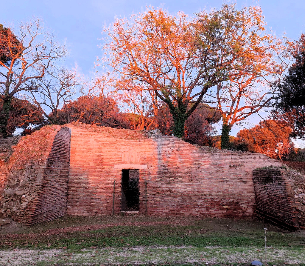
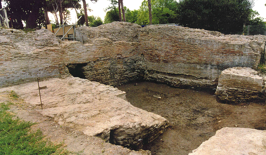
To the south-east of the hexagon the wall follows the north side of a curved channel (this channel was discovered recently by the Portus Project; see "Temple of Portumnus, Via Portuensis and aqueducts"). Here a short stretch of the wall was excavated by Guido Calza in 1925. He describes a brick wall, 1.50 m. wide and with butresses every 5.90 m. Later a second wall was set against the outside, also 1.50 m. wide.
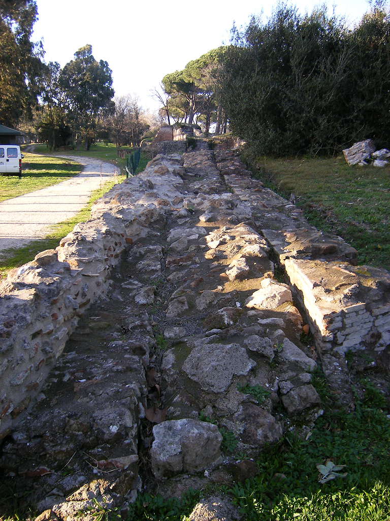
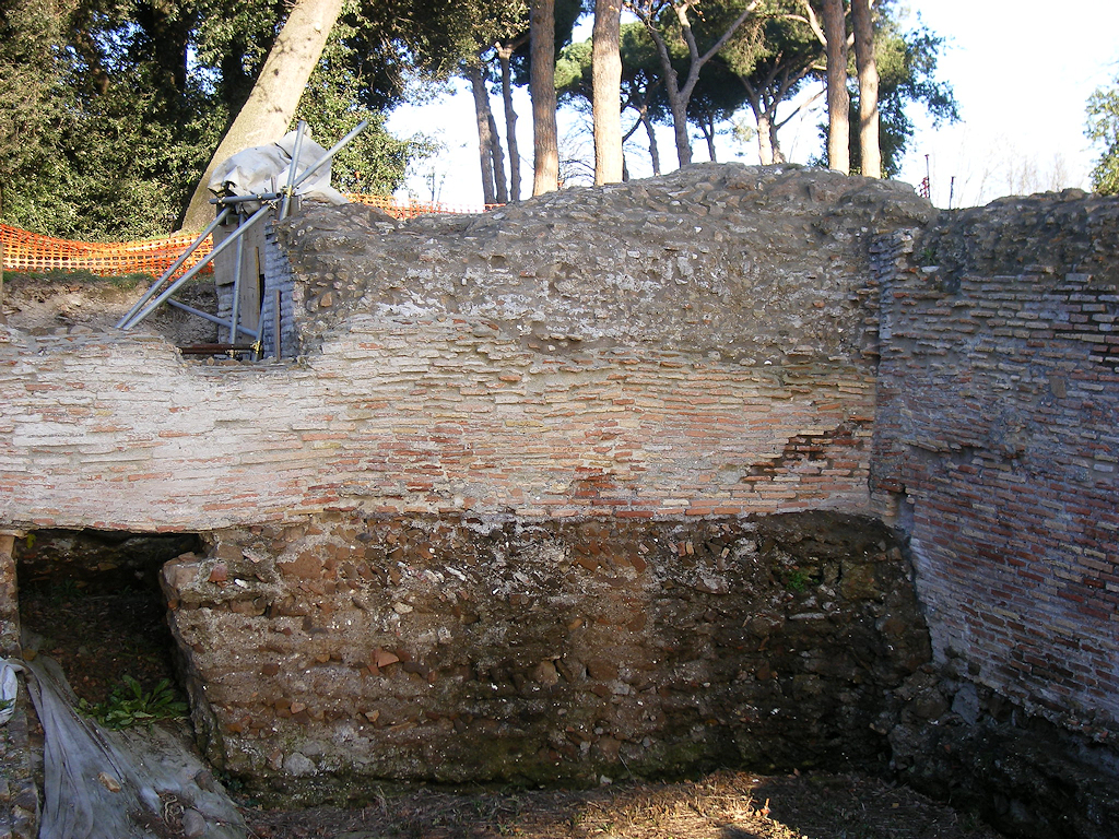
In the south-west, near the Porticus of Claudius, the wall is documented as part of the so-called Antemurale or Stronghold (nr. 1 on the plan above), where it reaches a maximum height of six meters.
Late walls set against an older wall with a small door ("posterula") of the Stronghold. Photo: Parco Archeologico di Ostia Antica.
View of the Stronghold. Photo: Portus Project.
View of the Stronghold. Photo: Parco Archeologico di Ostia Antica.
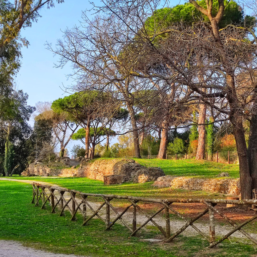
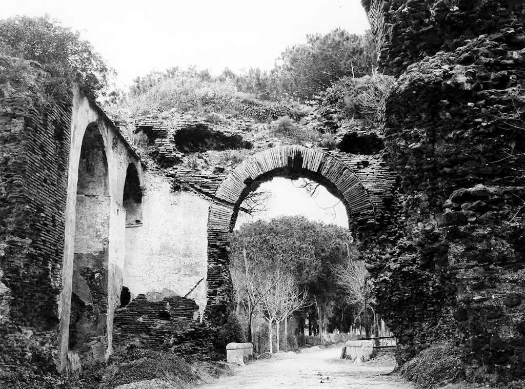
A late brick wall on the Stronghold. Photo: Portus Project.An internal city wall was also erected. In the west it ran along the north side of Great Horrea of Trajan, between the horrea and the channel that connected the basins of Claudius and Trajan. It then continued along the south side of the hexagon, where it made a sharp turn to the east, to link up with the wall along the newly discovered canal. This last short stretch has three towers. Near the hexagon it has a gate that was called Arco di Santa Maria in the Middle Ages. The maximum preserved height is almost ten metres. Through the internal wall the residential area to the south of the hexagon, with the Christian basilica, was turned into a fortress.
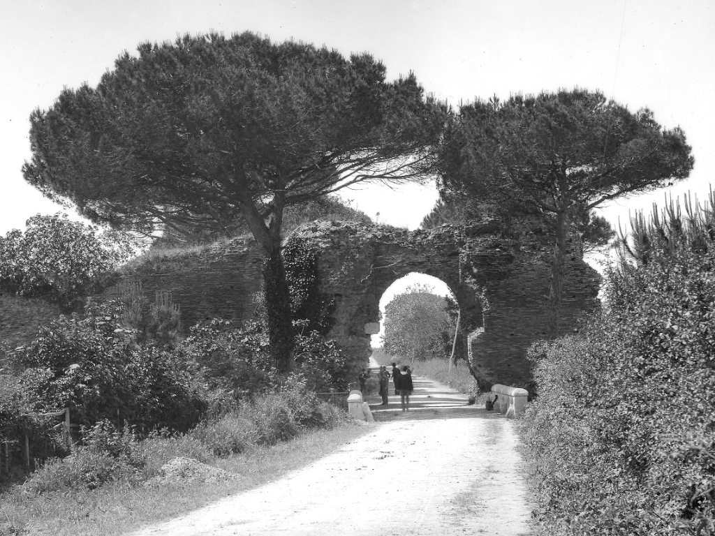
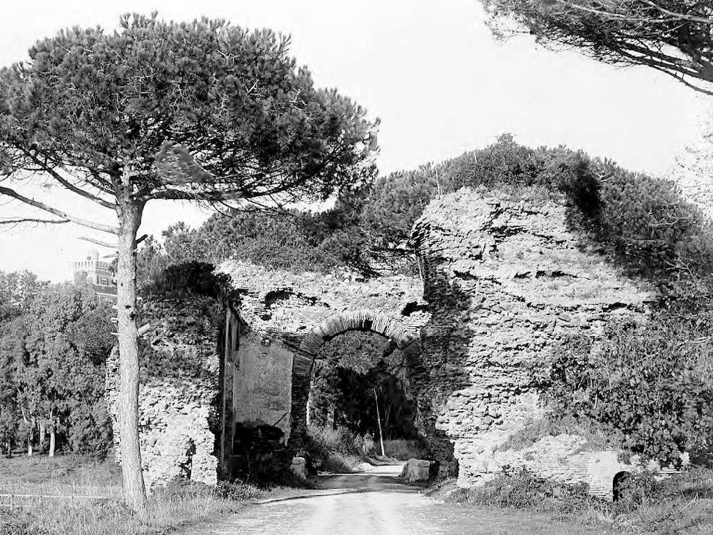
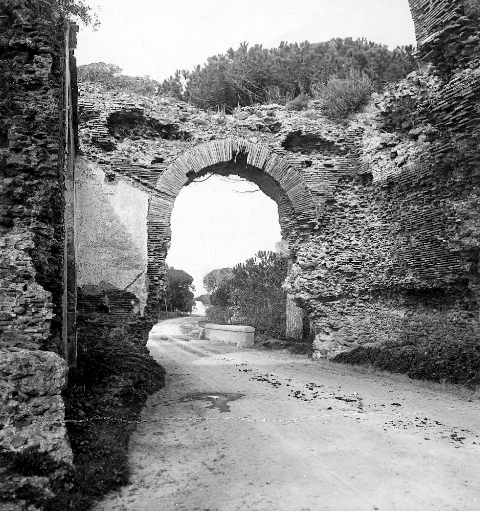
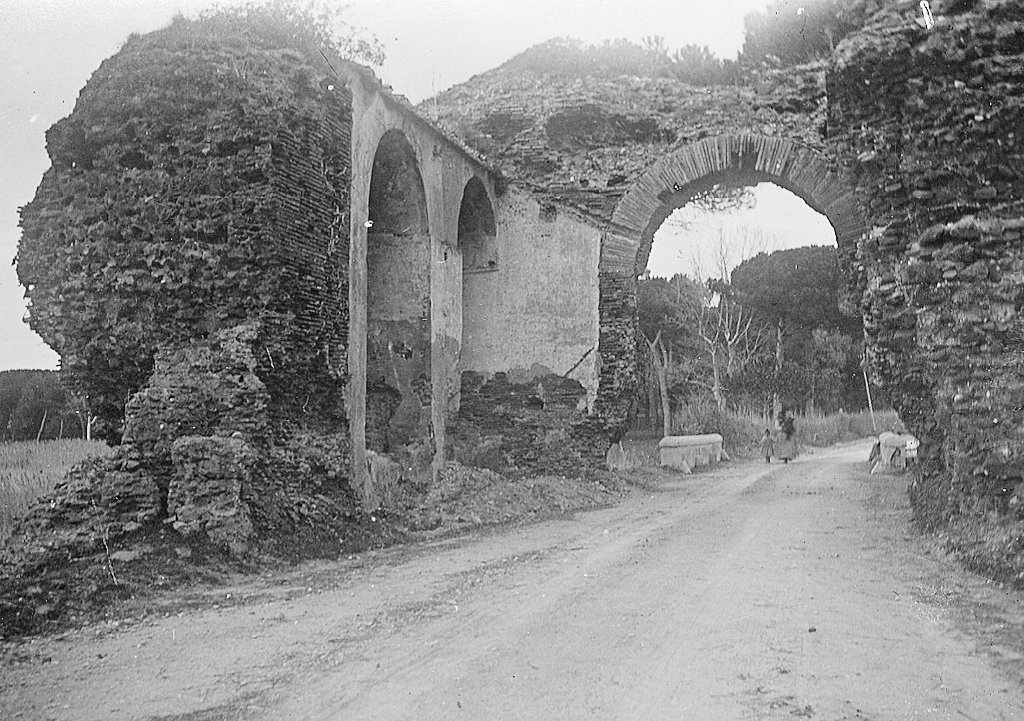
The Arco di Santa Maria around 1900. Photos: British School Rome (top four photos) and American Academy Rome.The wall has in the past often been attributed to the reign of Constantine, inspired by an inscription from Portus that calls a part of the port "Civitas Flavia Constantiniana". More recent research, published in 1993, suggested a different date. From pottery in trenches at two different locations (at the Stronghold and near the Porta Marina), Archer Martin has deduced that the wall was not built before the late fourth century. Stefano Coccia then suggested that it was probably built before Alaric captured Portus in 409 AD, because the historian Zosimus says that he besieged the city, which suggests a fortification. The masonry of the stretch with the Arco di Santa Maria is more accurate than that of the outer wall. It has a brick motif of a palm tree, pointing to a date around 400 AD. Ceramics from a trench dug later at the Stronghold, published in 2011, pointed to a date of the wall in the years 475-490 AD. The last word has not yet been spoken about the wall.
View of the most recent trench dug at the Stronghold. Photo: Parco Archeologico di Ostia Antica.Sources
See in the online bibliography the keyword "Portus - buildings - city wall" and: Nibby 1849, 618-620; Calza 1925, 65; Lugli-Filibeck 1935, 78, 91-96; Coccia-Paroli 1993, 177; Coccia 1993, 182-187; Keay et al. 2005, 291-296 and passim.
![]()
![]()