We have used Google Earth to indicate the position of many remains of Ostia and Portus: open the file ostia.kmz by clicking on the link.
After a long drought in 2007 an exceptional number of remains became visible. Fortunately, Google has preserved the photos. To see what can and might be visible, open the file ge2007.kmz. Next, in the Google Earth toolbar, select the images taken on July 29, 2007.
Important photos can also be seen in Bing Maps. Especially the bird's eye view, which can be rotated, has useful images. An absolute highlight are crop marks showing the remains of a very large building near the coast.
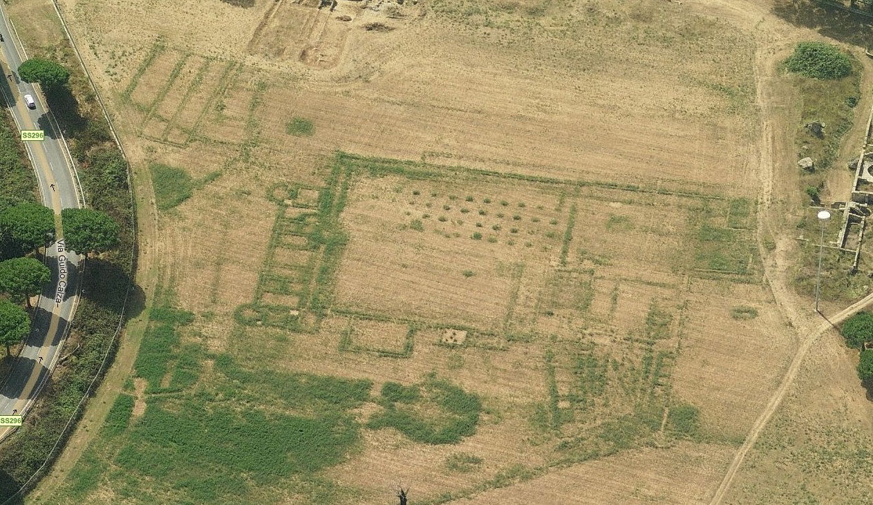
The building along the coast as seen in Bing Maps in the Spring of 2011 (from the north).