![]()
![]()
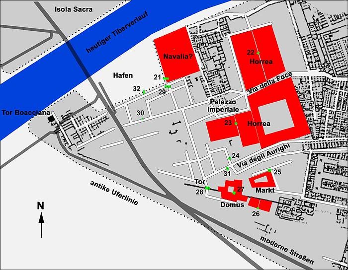
In 2000 geophysical research, conducted by the German Archaeological Institute in Rome, directed by Michael Heinzelmann, led to the discovery of a small harbour to the west of the Navalia. A depression in the terrain had been noted here a long time ago, and in 1830 Luigi Canina drew a semicircular structure on his plan of Ostia, which was not based on excavations however.
The west part of regions I and III with new discoveries, resulting from the geophysical research
by the German Archaeological Institute in Rome. Numbers indicate trenches. "Hafen" = harbour.
Plan: Michael Heinzelmann.The harbour basin, that is now filled with sand, was rectangular. The opening from the Tiber was c. 200 metres wide, the depth was c. 100 metres. Along the south side ran a road. The basin was quite shallow and could not be entered by larger cargo ships. It was used until the fourth century. In the third quarter of that century it was struck by a tsunami.
Computer reconstruction of the harbour, the Navalia and the Temple of the Dioscures.
Michael Heinzelmann.
![]()
![]()