![]()
![]()
THE MODERN NAMES OF THE LOCALITIES
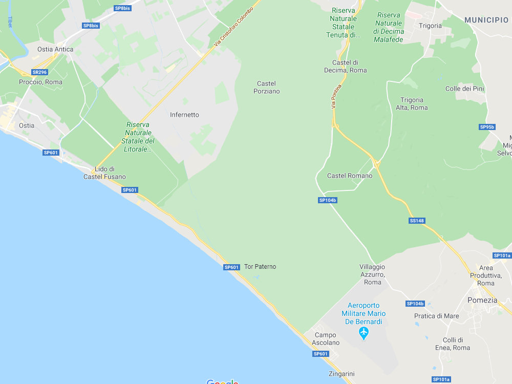
It is sometimes difficult to pinpoint the reported location of a Roman ruin, because names of localities are being referred to that are not always still in use. On the map shown below we see Ostia Antica in the top left corner, and below that once again Ostia, which is Lido di Ostia on the modern shoreline. In between is Procoio, the green area that we have just visited. The Canale delle Stagno is a line ending at road SP 601, crossing the white road leading from Ostia Antica in the north-west to the south-east. To the east is a large pine forest called Castel Fusano. It is bisected by a yellow road, the busy Via Cristoforo Colombo, which connects Rome's EUR district with the coast.
Beyond that is a very large, light green area. This is the Tenuta di Castel Porziano. Here is a residence of the president of Italy, and therefore the territory is not open to the public. There are guided tours however (for more information see the website of the presidential estate and this website about the archaeological museum on the estate). The name Porziano (also Porcigliano) is often explained as a derivation from the Roman family name Procilius. In this area, on the coast, was the Imperial villa of Tor Paterno. For our journey two places to the north-east should be noted: Trigoria and Castel Romano. The coastal area further to the south-east is known as Capocotta. Here Pratica di Mare is situated.
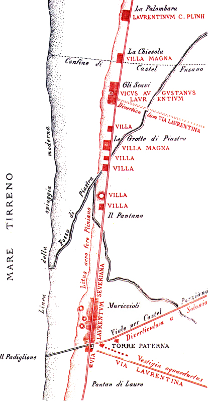
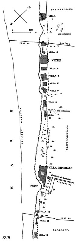
Below are two maps of the coastal area of Castel Fusano and Castel Porziano, with an indication of Roman ruins. The left one was published by the famous archaeologist Rodolfo Lanciani in 1903, the right one by the late Amanda Claridge, director of the British Laurentine Shore Project.
![]()
![]()